
What is Satellite Navigation Systems: Advantages and Disadvantages
Advertisement
Satellite navigation systems determine accurate position, velocity, and timing information by using signals transmitted from constellations of orbiting satellites. Their advantages include global positioning accuracy and continuous navigation services, while their disadvantages include signal obstruction, atmospheric interference and vulnerability to intentional signal disruption.
Key Features of GPS System
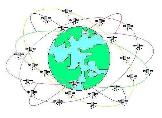
Satellite constellations are used to determine locations on Earth and assist in navigation from one place to another, much like stars were used in the past. There are currently four primary global navigation satellite systems (GNSS):
- GPS (USA)
- GLONASS (Russia)
- Galileo (European Union)
- BeiDou (China)
In addition to these global systems, there are also regional satellite navigation systems, including:
- QZSS (Quasi-Zenith Satellite System) developed by Japan
- IRNSS (Indian Regional Navigation Satellite System), also known as NavIC, developed and operated by ISRO. iNavIC covers India and surrounding regions up to approximately 1500 km.
Satellite Navigation System Segments
A satellite navigation system consists of three major segments:
- Space segment: The network of satellites in orbit.
- Control segment: The ground control network, including antennas, monitor stations, and control stations, responsible for managing the satellites.
- User segment: The receiver circuit within a handheld device (like a GPS chip) or integrated into a vehicle.
Each satellite utilizes highly precise atomic clocks to calculate the time it takes for a signal to travel from the satellite to a location on Earth. The signal transmitted by each satellite contains information about the satellite’s identity and a timestamp indicating when the signal was sent. When a GPS receiver picks up signals from three or four satellites, it can accurately estimate its precise location, including altitude.
Benefits or Advantages of Satellite Navigation Systems
- Navigation Assistance: Helps people reach their destinations efficiently.
- Tracking Capabilities: Useful for tracking parcels, stolen vehicles, missing persons, and valuable assets.
- Traffic Management: Improves vehicle traffic flow by guiding drivers around congested routes.
- Scientific Research: Aids in scientific studies related to meteorology, troposphere, and geodesy.
- Retail Convenience: Provides users with information about nearby retail outlets, enhancing the shopping experience.
- Free to Use: No charges or fees are required to access this service.
- Ubiquitous Availability: The service is accessible anytime and anywhere, self-calibrating, and easy for anyone to use.
Drawbacks or Disadvantages of Satellite Navigation Systems
- Power Consumption: The receiver consumes significant power, requiring battery power or recharging.
- Signal Obstruction: GPS signals cannot penetrate walls or solid structures, limiting their use in indoor locations, underground areas, dense forests, and underwater environments.
- Accuracy Limitations: GPS accuracy can be affected by factors such as multipath interference and electromagnetic wave interference, resulting in errors of approximately 5-10 meters.
- Reliance on External Control: The availability of GPS service is controlled by the USA, which has the potential to limit or deny access to users.
Summary
Satellite navigation systems have become indispensable for transportation, surveying, agriculture, logistics, defense, and mobile applications by providing precise positioning worldwide. Their operational advantages greatly improve navigation efficiency, although signal reliability and security remain important engineering considerations.
Continue Learning Radio Navigation Systems (VOR, DME, TACAN & More)
Deep dives into the radio-based beacons, direction finders, and navigation systems that have guided aircraft for decades.
- ADF (Automatic Direction Finder) Basics
- VOR (VHF Omnidirectional Range) Basics
- DME (Distance Measuring Equipment) Basics
- TACAN (Tactical Air Navigation) System Basics
- VORTAC (VOR + TACAN) Navigation
- DME vs TACAN Air Navigation
- RNAV (Random or Area Navigation)
- LORAN (Long Range Navigation) Basics
- OMEGA Navigation System
- DNS (Doppler Navigation System)
- INS (Inertial Navigation System)
- Dead Reckoning Navigation System Basics
- Dead Reckoning Navigation Method
Precision Landing Systems
Explore More Aeronautical Communications & Satellite Navigation Fundamentals
- Air Traffic Management Explained: A Deep Dive into ATM & LDACS
- AeroMAC: Aeronautical Mobile Airport Communications System
- Avionic Systems & Navigational Aids
- B-AMC: Broadband Aeronautical Multi-Carrier Communication
- What is DGPS (Differential Global Positioning System)?
- GNSS vs GPS: Understanding the Difference
- Satellite Navigation: Advantages & Disadvantages
Continue Learning Satellite Communication Technology
- Satellite Communication Basics Tutorial
- GEO Vs. LEO Vs. MEO Satellite Types
- Apogee and Perigee in Satellite Communication
- Satellite Capacity Allocation Types
- Satellite Frequency Bands
- Satellite Transponder Components & its function
- Satellite Bus vs Payload : Understand functions
- Satellite Ground Station Basics
- Satellite System Security Mechanisms & Standards
- Satellite Parking Lot Concepts and Procedures
- Satellite Launching Procedure and Processes
- Telemetry, Tracking and Command (TTC) in Satellite System