
What is LiDAR : 5 Advantages and Disadvantages
Advertisement
LiDAR (Light Detection and Ranging) is a remote sensing technology that uses laser pulses to measure distances and generate detailed three-dimensional maps. It is widely used in autonomous vehicles, surveying, robotics, and environmental monitoring. Advantages include high accuracy and resolution, while disadvantages include high costs and sensitivity to weather conditions.
Key Features and LiDAR Block Diagram
- LiDAR is an optical sensing technology used to determine the range of distant targets and other parameters.
- It uses Near Infrared (NIR) and Visible Light frequencies to image objects.
- Laser beams are used to measure properties of scattered light and to create points for 3D mapping.
- LiDAR is deployed on three main platforms: ground-based, airborne (airplane), and space-based.
- Common applications include meteorology, space exploration, transportation, vehicle anti-collision systems, robotics, and agriculture.
LiDAR can analyze targets made of a wide variety of materials, including dust, rain, non-metallic objects, molecules, and chemical compounds.
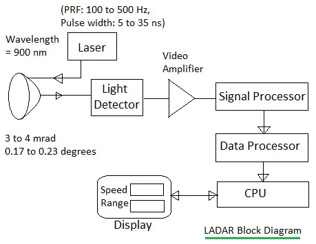
Figure-1 : LiDAR System Block Diagram
As shown in the figure, a typical LiDAR system contains a laser, photodetector, receiver electronic circuitry, scanner and optics, and position and navigation subsystems.
Applications of LiDAR
LiDAR is used in a diverse range of applications, including:
- Military: High-resolution LiDAR gathers detailed information to identify and target tanks during wartime.
- Transportation: LiDAR enhances safety by providing images with road contours, lane detection, localization, and roadside vegetation mapping.
- Geology: LiDAR creates high-resolution digital elevation maps, leading to significant developments in geology and soil science, which aids in agricultural farming.
- Robotics: LiDAR is used for environment observation and object classification in robotics applications.
- Airborne LiDAR: A laser is attached to an aircraft to create a 3D cloud model of the landscape during flight.
- Astronomy: Multiple LiDAR systems are placed in observatories worldwide to determine the position of the moon with millimeter precision.
Benefits or Advantages of LiDAR
- It provides very accurate surface measurements using 3D mapping techniques.
- The use of low wavelengths allows for the detection of very small objects, like cloud particles.
- LiDAR can determine the distance of the moon from various observatories with millimeter precision.
- It’s easily installed on ground-based, airborne, and space-based platforms.
- LiDAR used for localization and obstacle detection delivers 1.6 million 3D points per second.
- It’s particularly useful for dense forests with large height differences.
- LiDAR technology is fast in both data acquisition and processing.
- LiDAR technology is independent of weather and light conditions, collecting data at night and in slightly bad weather conditions.
Drawbacks or Disadvantages of LiDAR
- The performance of LiDAR can degrade in bad weather conditions.
- It can be difficult to track objects using LiDAR.
- It’s a relatively expensive technology.
- It’s not commonly used on satellite platforms, except for systems like GLAS.
- For more in-depth information, refer to the disadvantages of laser technology.
Summary
LiDAR technology enables precise 3D mapping and object detection using laser measurements. Advantages include accuracy and detailed imaging, while disadvantages include expense and environmental limitations.
Continue Learning LiDAR Fundamentals & Types
- LiDAR as Target Detection and 3D Mapping/Imaging
- LiDAR 905nm vs 1550nm Differences
- Flash vs Scanning LiDAR Differences
- Mechanical Scanning vs Solid-State LiDAR Differences
- Single-Shot vs Multi-Shot LiDAR Differences
- dToF vs iToF LiDAR Differences
- Legacy vs Modern LiDAR Detectors Differences
Explore Technology Comparisons (LiDAR vs. Radar vs. Cameras)
- LiDAR vs Radar: Understanding the Differences
- LiDAR vs LADAR Differences
- LiDAR vs Time of Flight (ToF)
- Radar vs LiDAR vs UWB vs Camera Comparison
Explore More LiDAR Engineering Calculators
- LiDAR Distance Calculator and ToF Formula
- FMCW LiDAR Distance Calculator and Formula
- iToF LiDAR Distance Calculator and Formula
- LiDAR Received Power Calculator and Formula
- LiDAR Point Density Calculator and Formula
- 3D LiDAR Point Coordinate Calculator and Formula
- Bathymetric LiDAR Depth Calculator and Formula