
Shapefile vs. Geodatabase: Key Differences Explained
Advertisement
This article compares Shapefile and Geodatabase, highlighting the key differences between these two popular geospatial data formats.
Shapefile
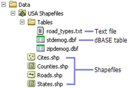
- Shapefiles are stored as a collection of files within a folder.
- Shapefiles do not support topology. This means they lack built-in mechanisms for enforcing spatial relationships and data integrity rules.
- Shapefiles typically support single-user editing, making them less suitable for collaborative environments.
Geodatabase
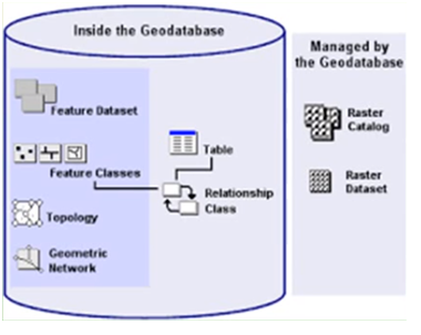
- Geodatabases offer flexible storage options. They can be stored in:
- A common file system folder (file geodatabase)
- A Microsoft Access database (personal geodatabase - deprecated)
- A multi-user relational DBMS such as Oracle, Microsoft SQL Server, PostgreSQL, Informix, or IBM DB2 (enterprise geodatabase)
- Geodatabases support topology. This allows you to define and enforce spatial relationships between features, check data integrity, and find errors.
- Geodatabases support advanced datasets. You can add network datasets (for routing), geometric networks, terrain datasets, parcel fabrics, and run topology on existing layers.
- Enterprise geodatabases provide robust multi-user controls, including edit permissions, access privileges, and versioning.
- Enterprise Geodatabases are the preferred choice for enterprise GIS systems requiring concurrent access and data management.
- Refer to the advantages and disadvantages of Geodatabase for a more detailed comparison.
It’s generally easy to convert shapefiles to geodatabases in ArcGIS and other GIS software.
Advertisement


