What is GIS : 5-10 Geographical Information System Advantages and disadvantages
Advertisement
A Geographic Information System (GIS) is a computer-based framework used to collect, store, analyze, and visualize spatial and geographic data. It supports urban planning, environmental monitoring, transportation, and utility management. Advantages include powerful data analysis and visualization capabilities, while disadvantages include implementation costs and technical complexity.
Key Features of GIS System
- GIS is a Geospatial mapping technology which stands for Geographical Information System.
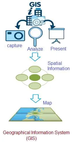
- It is a business information management system which helps to capture, analyze and represent spatial information on a map.
- It allows us to make better decisions based on geography.
- Data viewing on this digital map is easier than spreadsheets.
- GIS software runs on computers ranging from powerful servers to software on the mobile phone.
- GIS tools help to visualize geographic data as maps, graphs or charts. Hence, patterns and trends can easily be identified unlike spreadsheets.
- The functions of GIS (Geographical Information System) include data entry, data display, data management, information retrieval and analysis.
- A data model in GIS is a mathematical construct which represents geographical objects or surfaces as data.
- There are three common representations of spatial data used in GIS viz. vector, raster and triangulated. Each of these are used for particular kinds of information and their analysis.
- GIS is one of the forms of geospatial technology. The other examples include GPS, satellite remote sensing and geofencing.
Key Components of Geographic Information System (GIS)
Key components and functionalities of GIS are as follows:
- Data Collection: GIS starts with the collection of geographic data, which can be obtained through various means such as GPS (Global Positioning System) devices, remote sensing (satellite imagery, aerial photography), surveys, and digitization of existing maps.
- Data Storage: Geographic data is stored in a digital format in databases or file systems, allowing for efficient retrieval and management of information. This data can include various types, such as vector data (points, lines, polygons) and raster data (gridded images).
- Data Analysis: GIS software provides tools for analyzing and processing spatial data. Users can perform operations like overlaying different layers, spatial querying, buffering, proximity analysis, and statistical analysis to gain insights from the data.
- Data Visualization: GIS software allows users to create maps and visualizations that represent the geographic data in a meaningful way. These maps can include symbols, labels, colors, and other elements to convey information effectively.
- Data Integration: GIS often involves integrating various types of data from different sources to create a comprehensive view of a geographic area. This may include demographic data, environmental data, infrastructure data, and more.
- Decision Support: GIS is used extensively in decision-making processes across various industries, including urban planning, natural resource management, environmental monitoring, public health, transportation planning, and many others. It helps decision-makers by providing spatial insights and supporting scenario analysis.
- Geographic Information System Software: There are many commercial and open-source GIS software packages available, such as ArcGIS, QGIS, and MapInfo, that provide the tools and capabilities needed to work with geographic data.
Applications of GIS
Following are the applications of GIS (Geographical Information System):
- Retailers use GIS to pinpoint best locations for new stores and stock items which matches local customer needs.
- It is used to predict consequences of global warming by conservation organizations.
- GIS is used by electric utility companies to respond efficiently and promptly about power outages.
- It is used by police to discover patterns in criminal activity.
- It is used for land use planning, landscape assessment and planning, transportation and infrastructure planning, market analysis, facilities management, real estate analysis and so on.
- Emergency response and disaster management.
- Archaeology and cultural heritage preservation.
- Public health and epidemiology.
10 Advantages of GIS (Geographical Information System)
- GIS explores both geographical and thematic components of data in a holistic way.
- It allows handling and exploration of large volumes of data.
- It allows integration of data from widely disparate sources.
- It allows analysis of data to explicitly incorporate location.
- It allows wide variety of forms of visualization such as maps, globes, reports, charts etc.
- GIS provides very accurate data.
- It provides better predictions and analysis.
- GIS provides the capability to create visually compelling maps and graphics, making it easier to communicate complex geographic information to a wide audience, including non-specialists.
- In fields like urban planning and emergency response, GIS helps optimize resource allocation by identifying high-priority areas and efficient routes for service delivery, leading to cost savings and better response times.
- GIS is invaluable for environmental monitoring, infrastructure planning and natural resource management.
5 Disadvantages of GIS (Geographical Information System)
- GIS tools are expensive.
- Learning curve on GIS software can be long.
- It shows spatial relationships but does not provide absolute solutions.
- Integration with traditional maps is difficult.
- It (Desktop GIS) requires an efficient processor and higher storage space.
Summary
GIS helps organizations analyze and visualize location based information. Advantages include improved decision making and mapping capabilities, while disadvantages include high setup costs and specialized skill requirements.